Sunday, November 25, 2007

Election weekend Search


Liberal, Labor, Lantana.


The winner is LANTANA.


Here are some photos of our election weekend search.
Another grid square ticked off the map and still no closer to finding the plane. When i go searching i don't think about finding the plane anymore. It's just bush walking with a purpose, a navigation exercise. In the early years i would dream of coming up to Barrington tops and finding MDX. The novelty soon wore off,but i still keep coming back. Mainly due to the optimism of the the boys who are always fired up to keep going no matter what. This search is as much theirs as it is mine.
The boys were swinging their machetes back and forth like wild men as we cut our way down stream. A "debate" about the direction we were going had me swallowing humble pie as the navigation of Andrew, Craig and Gareth was spot on. Delivering us right back to our last position on our previous walk.
With their usual thoroughness Craig and Gareth left no stone unturned as they hacked through vines,lantana and stinging nettles. Dropping into the valley the hills started to close in on us and walking became difficult. Craig went arse over a log with Gareth following suit soon after. Only some serious tree hugging stopped him falling further down the hill. I would have liked to help but my stomach hurt from pissing myself with laughter to be of any use.
On a couple of occasions throughout the day i thought we were going to be flicking the switch on the E.P.I.R.B. when Craig slipped on a rock in the creek. In one of those cartoon banana peel trip ups. Craig's legs went above his head and he landed flat on his back. His back pack was the only thing that broke his fall and prevented him from cracking his skull on the rocks. The other was near the end of our walk when Gareth nearly stood on a Tiger snake. Whoever said that snakes move out of the way when they feel you coming is full of shit. This snake held his ground until we skirted around him. By mid afternoon we reached our cut off point and began our climb up the mountain just in time for the rain to make our walk back to base camp all that more memorable.
It's a good moment when you finally get back to camp with a hot meal under your belt, dry clothes and have a laugh at what might have been.


Tuesday, November 20, 2007

Oil slick found on water surface


This is the official finding on the oil slick that was found floating on the water the day after MDX went missing. It was suggested that the plane had crashed into Chichester dam and the oil slick was a result of that crash.

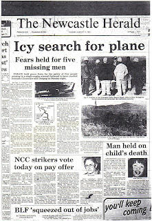
Newspaper articles


Tuesday, November 13, 2007

Monday, November 12, 2007

Search team


Sam R.I.P.


Jeff Peck " Finder of the elusive African barking spider"


Jack Dennard


Andrew Mcgilvray & Gareth Wastell


Craig Rye "the machine"


Nev Dennard "chief cook and bottle washer"


The following people have all been involved in the search for MDX in the early years or on the current expeditions. When I've lost interest in the search or just wanted to give up. These guys keep providing me with the Inspiration and the motivation to keep looking.


They are:

Craig Rye
Andrew McGilvray
Gareth Wastell
Jack Dennard
Jeff Peck
Paul Adams

Special mention goes to Jeff Peck who is always there when i need him. His generosity knows no bounds. I cant thank him enough for all the support he has given me over the years. Craig Rye for his determination to push through obstacles physical and mental. Everyone should have a Craig Rye on their expedition. Lastly to my wife kim. Without her support none of this would be possible. She has spent countless hours listening to my theories, spreading my maps over the dining room table, my sudden trips to the library or spending all day chasing leads from Wollongong to the Gummi plains. She is a very special woman.


Wednesday, November 07, 2007

Repair Log


Conversations

  • Conversation with Bette May Diver. Witness to flare sightings on the night of the plane crash.

Bette was driving over the bridge at Glenwilliam at approximately 10 pm when she saw a white light over the mountains North West of Dungog. Her daughter Lyn was lying asleep next to her.She woke her daughter up and said did you see that. The white light seemed to stay up in the sky and then slowly drop and then seemed to "fold into itself". She turned onto Alison road where she could get a clearer view of the night sky. When she and her daughter saw the second white light do exactly the same as the first light.

  • Conversation with Mrs Dell O'hare. Gummi Plain, 12 miles from Hunter Springs

Mrs O'hare was talking to her sister on the phone that night at around 7:00 - 7:30 pm. She heard a roaring of an engine, the sound was oscillating. She looked out her window, the weather was bad that night but there were clear patches. She looked out the window and saw the planes lights. She thought it odd that the plane was going in a direction that planes that usually go overhead dont follow. Her sighting was never investigated by police.

Conspiracy theories


Mike Hutchins Pilot of VH-MDX which crashed on the 9th of August 1981 and the victim of a second air crash had worked for a Sydney company that helped develop a top secret sonar defence system to detect russian submarines. Hutchins and Stuart Sims were employed as engineers by Electronic Systems and Management Services of North Sydney and were party to the Official Secrets Act.

Sim's died on the 27th of December 1980 when the Piper Tomahawk he was flying crashed into Lake Macquarie. An article in the "Australian" newspaper said that the commercial manager of ESMS rejected any suggestion that the deaths of Hutchins and Sims were related to the work in which they were both involved.
This is just one of the many theories that make up the mystery surrounding the dissappearance of MDX. In all the years of research on this subject I have heard them all. They were gun running, transporting drugs,someone even told me that there was a bloke who knew a bloke who knew a journalist that had a photo of the plane sitting on the runway of Darwin airport two days later. Another one was that the plane crashed into Chichester dam because there was an oil slick found on the water surface. Well that theory was also blown out of the water so to speak. A sample was taken and analysed and found to be a type of algae bloom. No traces of aeroplane oil or fuel was found.
Everyone loves a mystery including me. These stories about drugs and guns spice up the story but the facts remain that it was an accident where contributing factors all played their parts in the tradgedy. The pilot was offered an alternate route, He did'nt want to wait for clearance. He continued on his original track. The winds over the mountains that night were 70 knots. Only a pilot or a sailor would understand how powerful those winds were. Add ice on the wings plus faulty navigational equipment and you had a recipe for disaster.
A book I can recommend to read is "Crash - the search for the Stinson" or "Green Valley by Bernard O'reilly" You realise that normal people get caught up in the hysteria of the event and want to believe they heard or saw something. I remember reading that at least a dozen or so people swore they saw the Stinson fly overhead in the Sydney or Hawkesbury area. When in fact the Stinson crashed in the Lamington state forest in Queensland only an hour into its flight.
So stay sceptical and remember that Newspaper information is never to be trusted.

Search summary August 1981


Search Areas


In the air:


  • Search area covered 20 mile radius from Berrico trig.


  • From Nundle to Nowendoc in the north to Warkworth and Clarencetown in the south.


  • Eleven fixed wing aircraft and ten helicopters contour searched the mountains.


  • 412 hrs of air search conducted.


On the ground:


  • Bushwalkers wilderness rescue


  • Police and S.W.O.S. units


  • State emergency service


  • Army reservists


  • Forestry rangers


  • 4WD clubs and motorcycle riders


  • RAAF photo reconnaissance of area


  • Landsat satellite to scan the search area


Over 400 people involved in the largest ever civilian search and rescue of its time.


Seach conducted from the 9th to the 18th of August 1981.


Air Safety Investigation Report


Last observed radar position


Flight Plan


Tuesday, November 06, 2007

The Terrain


On numerous walks through Barrington tops on my own and with my mates we've seen the extremes of this wilderness. From triple canopy rainforest to scrub you have to hack through with a machete. Covering sometimes as little as five kilometres in a day. Climbing up the sides of hills with a slope of forty five degrees in forty degree heat. Walking past creek beds with the ice cracking under your feet and icicles on the trees. I've lost count of how many times we've lost our way when we were'nt concentrating. Every time we come back from a search theres always a debrief about lessons learned on the walk.

On every search we now carry a GME EPIRB, GARMIN GPS, flares, maps, first aid kit, marker tape and I leave a copy of my planned walk with my wife.
Always on the lookout for a smarter (lazy) way to do things I decided I would charter a plane to speed up my search of an area. I found a pilot who early one Saturday morning took me over the tops lifting off from Scone aerodrome. We ran the length of area i needed to check out but even with the pilots considerable skill at low level flying we only got a fleeting look over the terrain. Whilst flying back over the tops the pilot forgot to mention to me that we were in an acrobatic plane. He then proceeded to do a couple of "barrel rolls" With me screaming like a girl. The newspaper headlines flashed in front of my eyes. " Plane lost while looking for lost plane".
It would be nice to have some funding to organise some serious " Quickbird" satellite imagery. But until then the only way this plane is going to be found is on foot with a systematic deletion of a grid area.
The Bushwalkers wilderness rescue uses this technique every year in their annual search and rescue training on Barrington tops.
Speaking of deletion of grid areas. A bloke from work named Dave Warland gave me the idea back in 2002 to delete hundreds of hectares out of the equation. Since the area is state forest, why dont i ask the state forests department for a map of all the areas logged since 1981. On the assumption that if an area was logged and the plane was in there it would have been found. This brilliant idea helped to remove quite a few hundred hectares off the maps.

Aircraft Incidents on or around Barrington tops

  • 16-04-45 Mosquito A52-70 Aeroplane hill

  • 30-10-47 Hudson VH-SMH 2KM S E Muswellbrook

  • 02-09-48 DC3 VH-ANK Square peak

  • 14-09-54 Hudson VH-SML 6KM E C hichester

  • 25-09-67 Mirage A3-52 Berrico trig

  • 16-08-68 C172c VH-DNK 28KM E Scone

  • 03-04-73 Mirage A3-77 8KM S Gloucester

  • 14-06-75 Piper Cher VH-WIK 27KM N W Scone

  • 13-05-76 Beech Mis VH-MJA 45KM E S E Scone

  • 18-01-79 Piper Cher VH-SYN 40KM S Quirindi

  • 22-03-79 C172n VH-KNA 13KM E Quirindi

  • 02-07-80 C172n VH-FOX 22KM N E Coolah

  • 09-08-81 C210 VH-MDX .................................

  • 13-12-81 Beech 35 VH-FBM 15KM N E Cassils

  • 11-11-82 Piper Cher VH-UDX Gloucester
  • 15-09-08 Cessna 206 55km NE of Scone

Monday, November 05, 2007

Cessna details


A picture of a Cessna 210 (Not VH-MDX)


Cessna 210 specifications


Cessna T210 Turbo System Centurion


Cessna Aircraft Company U.S.A.


Type L/A light aviation


1966


285 H.P. Continental TS10-520-c-tp


Wing span 36.9 ft / 11.20 M


Length 28.3 ft / 8.61 M


Height 9.7 ft / 2.92 M


Empty weight 1880 lb / 853 KG


Max take off weight 3800 lb / 1724 KG


Max speed 168 mph / 270 KM


Cruising speed 158 mph / 254 KM


Range 585 miles / 941 KL


Ceiling 13,300 ft / 4054 M


Crew 1


Passangers 6


VH - MDX Details


Serial number 21061678


Continental engine 10-520-1-3A


Mc Cauley propeller D3A32C88


Serial number 768686


Four of the crew on board the yacht to Proserpine


The crew of VH-MDX
Michael Charles Hutchins 51 Pilot


Rhett Eugene Bossler 33 Finance Broker


Kenneth Clyde Price 54 Police Inspector


Phillip Stanley Pembroke 41 Company Director


Noel Clyde Wildash 40 Managing Director


Friday, November 02, 2007

Last radio transmission from MDX to Sydney tower


  • Routine flight from Coolangatta to Bankstown until 7:24pm. There was thick cloud from 3,000 to 5,000 feet while mountains in the area reach as high as 5,000 feet. Thirteen minutes passed between the first message of trouble and the last.


  • 7:24pm
    Pilot advised Sydney control he was in heavy cloud and having trouble with his artificial horizon.(This keeps the plane in level flight when he cannot see the horizon)


  • 7.25pm
    Pilot reported that his automatic direction finder was rotating and could not make sense of it.


  • 7:35pm
    Pilot radioed that there was severe icing on the wings and the plane was losing altitude.
    (Plane had dropped 2,000 feet in 2 minutes)


  • 7.37pm
    The pilot said he was having trouble with his standby compass and was encountering heavy turbulence.


  • 7:39pm
    The pilots last message was short, he said (5,000)
    Sydney air traffic control then lost contact with the plane.

Thursday, November 01, 2007

Coronial Inquiry


The five men were returning to Sydney after sailing a yacht from Sydney to Proserpine in North Queensland. The aircraft was flown from proserpine to Coolangatta where the plane was refuelled for the second leg to Bankstown airport. The weather forecast was for occaisonal severe turbulence below 12,000 feet. The aircraft departed Coolangatta and subsequently at Taree at 8,000 feet. At this time Sydney air traffic control asked if clearance over Williamtown would be preferred to the planned route over Craven,the pilot indicated that it would.
He was instructed to remain outside Williamtown controlled airspace until clearance became available. Due to the delay the pilot elected to proceed on the planned flight track via Craven and Singleton. At 1919 hours he reported at Craven at 8,000 feet experiencing turbulence in cloud and was climbing to 10,000 feet.
Immediately after this he had advised that he had lost his artificial horizon and direction indicator. The aircraft was positively identified on Sydney radar at 36 miles north of Singleton and subsequently by Williamtown radar over Barrington tops. It did not appear to be maintaining a steady heading and the pilotreported that there was ice building up on the wings. He was then given a radar vector to West Maitland. The pilot then reported a major loss of altitude (2,000 feet in 2 minutes)
The final transmission received by Sydney was (5,000) the time was 1930 hours. The last radar fix on the aircraft was near Mt Cockrow in the far west of Chichester state forest. An extensive air and ground search was immediately commenced and continued for nine days without success.
Subsequently the search has been reactivated on a number of occasions in response to reports of wreckage being sighted. However no trace of the aircraft or its occupants have been found. The cause of the accident has not been determined but severe turbulence,icing and failure of the aircrafts primary flight instruments are possible factors.
The coroner determined that (paraphrased)
"That the occupants died each or seperately on or about the 9th of August 1981 when the aircraft in which they were travelling crashed into the mountains in the Barrington tops area".
The coroner did not attribute the blame to the pilot or to the lack of airworthiness of the aircraft.